
Dictionary, Census of Population, 2021
Figure 1.4
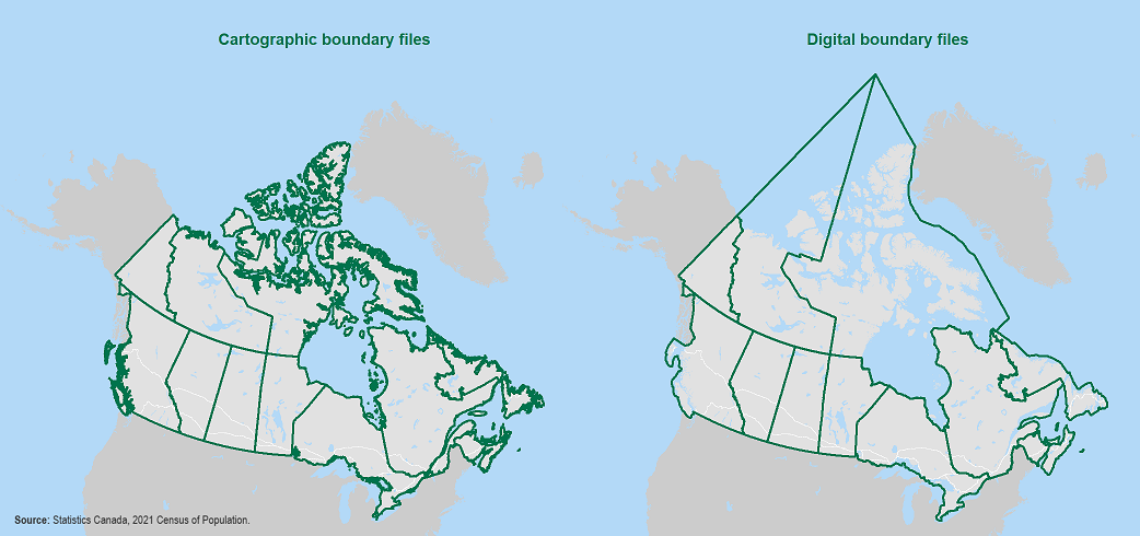
Example of a cartographic boundary file and a digital boundary file (provinces and territories)

Description for Figure 1.4
Figure 1.4 shows two representations of Canada's provincial and territorial boundaries. The map on the left shows an illustration of Canada as it appears in a cartographic boundary file. It is a detailed representation of Canada's land masses (including islands) and shorelines. Internal bodies of water, such as major lakes and rivers, are also shown.
The map on the right shows a map of Canada as it appears in a digital boundary file. It is a generalized illustration of Canada's boundaries. Each province and territory is represented by a single polygon; thus, the boundaries extend into bodies of water rather than follow the shoreline. As a result, boundaries may cut through lakes, extend into oceans or follow the approximate centres of rivers.
Source: Statistics Canada, 2021 Census of Population.
- Date modified: